
Swaddywell Pit is important for its wildlife and geology – the two are closely linked. The limestone, which was quarried for building stone at Swaddywell, supports the calcareous grassland and flora. It also reveals an interesting story about past environments and a time – 160 million years ago – when much of Northern Europe was under the sea … a geological period known as the Jurassic. The rocks at Swaddywell were laid down in a tropical Jurassic sea and have since been pushed and pulled by earth movements.This has created an interesting geological pattern.
Follow the site’s geology by walking to the signed area at the bottom of the quarrtrail to find out more …
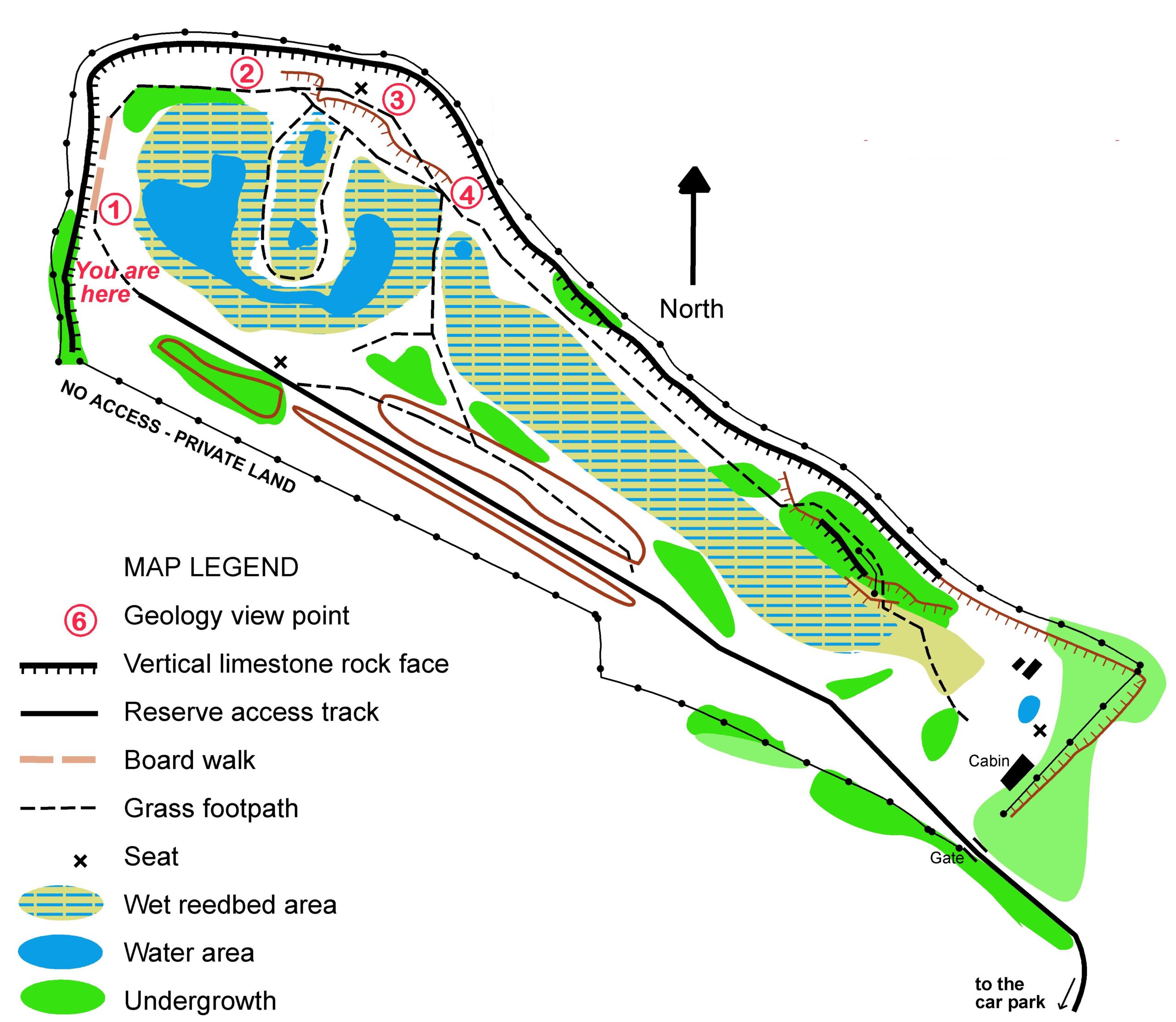
START: STEP ON TO THE BOARDWALK As you follow the boardwalk, look for fossils. Notice how the limestone beds are broken up and weathered.
Point 1 – Boardwalk
Look for fossils As you follow the boardwalk keep looking for fossils. Notice how the limestone beds are broken up and weathered. Here the limestone beds tilt gently to the north. You can also see vertical joints in the limestone caused by earth movements that have tilted and fractured the stone beds. Sometimes the limestone has moved along these fractures producing a fault that offsets the stone on either side.
The joints and faults have allowed water to travel through the stone weathering and eroding the face. In places, this process has widened the joints into fissures, which have become filled with clay.
Limestone is also porous allowing water to enter. When the water freezes it expands breaking the limestone’s outer surfaces. This gradually erodes the face leading to the build up of scree; this is a good place to find fossils.

NEXT Follow the boardwalk to the end and then follow the path in front of the quarry’s northern face.
Point 2 – Start of the fault
The Fault You are now walking along towards the Tinwell-Marholm fault.. The rocks have been fractured and moved. To the north, the limestone beds which formed the bottom of the boardwalk face, have been pushed up along the fault.
The Tinwell-Marholm fault runs from the west of Stamford to the west of Peterborough and has offset the limestone beds on either side by up to 20 metres.

HEAD UP THE RAMP As you walk along the northern side of the quarry the path leads you up a ramp. Notice changes in the rocks and take time to look back at the view across the quarry.
Point 3 – Tinwell-Marholm Fault
Sandy appearance You are now on the line of the fault. Sands and silts are exposed in the northern quarry face. They are relatively soft and can be recognised by the rabbit burrows. This sand and silt belongs to the Grantham Formation, which lies under the Lincolnshire limestone and has been lifted up by the Tinwell-Marholm Fault. These sands and silts were probably deposited on the sand banks and mud flats of an estuary.
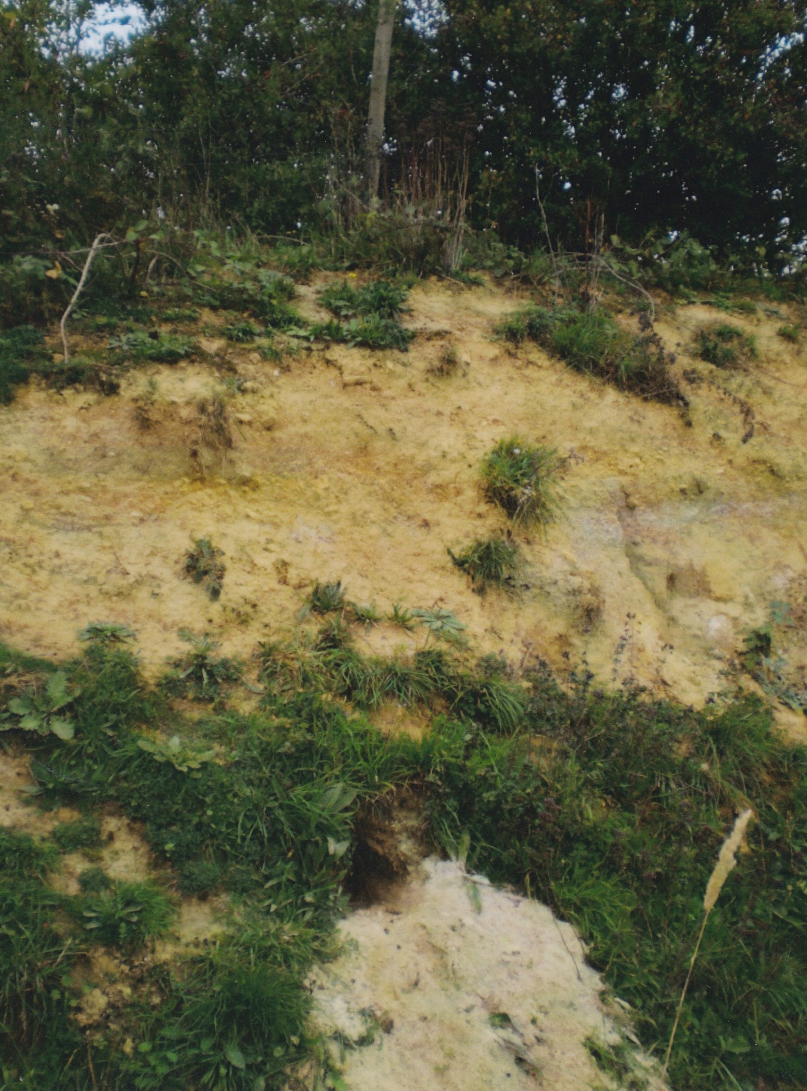
View the quarry The view of the quarry shows the effect of the Tinwell-Marholm Fault. The fault marks the northern limit of the quarry, the main limestone that was quarried has been cut off by the fault.
To the north the fault has also lifted up the underlying Whitby Mudstone Formation. You can’t see these rocks today, but in the past the clays the formation were dug in Helpston Brick Pit to make bricks.
Lifting up the underlying clays along the fault has also allowed the ponds to develop in the reserve.
NEXT Continue to walk along the northern face until you reach the area where the Lincolnshire Limestone and the Grantham Formation sands are both exposed.
Point 4 – Folded Limestone
Folds At several places along the northern face, and in this area, the limestone tilts steeply towards you and to the south. These steeply inclined beds represent a ‘drag fold’. It was created as beds on either side of the Tinwell-Marholm Fault were dragged against each other and bent as they resisted the movement. The beds to the north have been dragged and folded downwards as the beds to the south have dropped.

The path back to the cabin now follows the fault – at intervals you can see the smashed rocks and sand/clay layers until the final (quarried) north east face where fallen clay/sandy soil is dominant – and a wholly different set of plants emerges.