Our Artists in Residence have their say …
Langdyke Countryside Trust’s Artists in Residence are Sarah Lambert, a renowned ecologist and photographer, and Kathryn Parsons who has had research-based artworks exhibited widely
Cyanotype process creates amazing portraits
Kathryn Parsons on one of their latest projects
For Langdyke’s Annual Meeting on 17th July 2025, Sarah Lambert and I created more than fifty miniature portraits of plants and feathers found on Langdyke’s nature reserves.
We used cyanotype to create them. Often described as the earliest form of photography, it involves mixing chemicals to create a light-reactive solution which is painted on to the paper. Objects are then placed on top and put in the sun to develop.
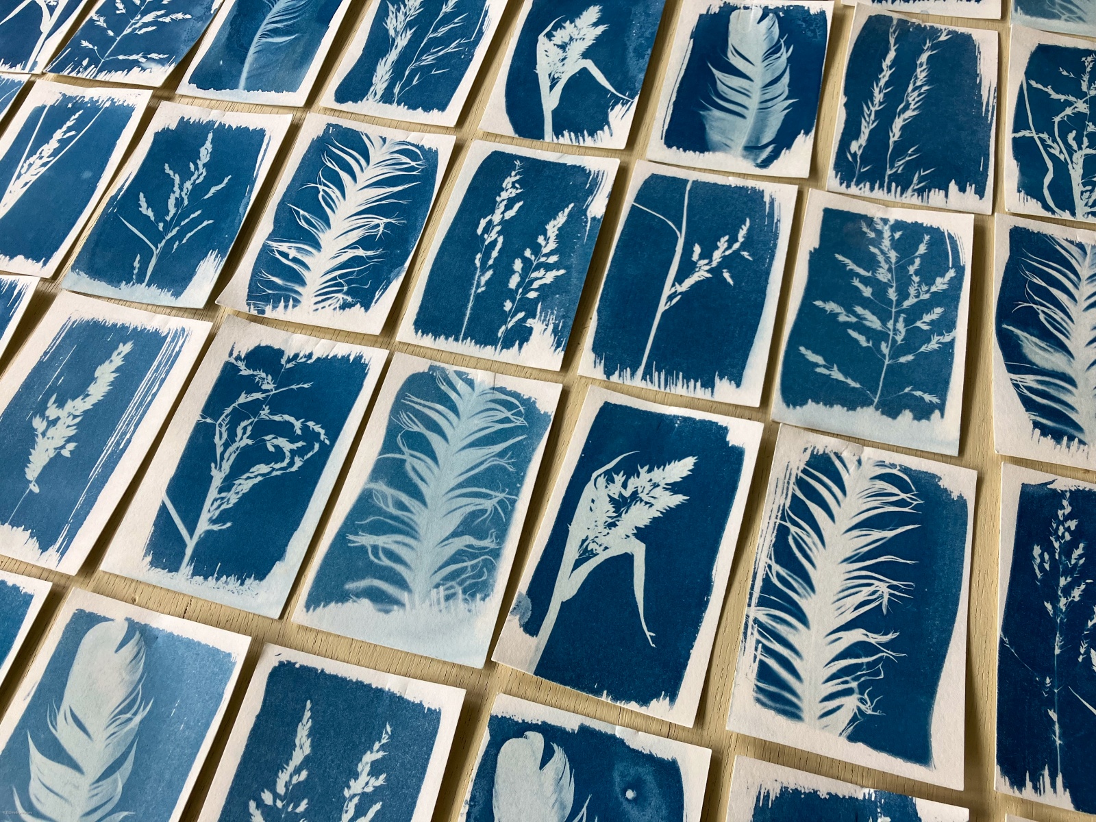 We were working on one of the sunniest days of the year, and with very high UV levels the cyanotypes only took a few minutes each! On cloudy days it can take half an hour or more.
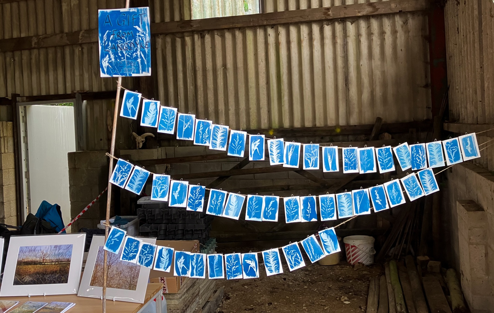
Once dried and ironed (!) we hung them in the barn and invited everyone at the meeting to choose one – as a thank you on behalf of Langdyke, and the plants and animals that live on the reserves.
August 2025
Looking back over 2024
Kathryn Parsons and Sarah Lambert reflect on another busy year for the Artists in Residence
Capturing the fleeting beauty of local micro-seasons through photography and natural dyeing has been our main focus this year. Using plants from Langdyke’s reserves, we have dyed and eco-printed wool—paying homage to the area’s long association with sheep, from Neolithic farmers to Langdyke’s conservation-grazing flock.
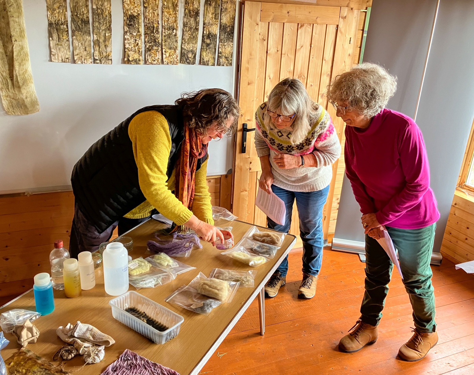
In September, we taught an experimental plant dyeing workshop at Swaddywell and Torpel nature reserves.
Participants explored, foraged, discovered nature’s subtleties, learned botany, paused to reflect, shared poetry, unearthed site histories, and coaxed vibrant hues from leaves and petals! Every piece of dyed fabric became a canvas rich with memories, rooted in place and time.
Torpel’s fascinating Medieval domestic history was the inspiration for a delightful Medieval finger-loop weaving workshop in August. While sharing stories of the site’s past and its current wildlife, participants wove and knotted beautiful objects that combine traditional skills with natural treasures.

We shared our work at Langdyke’s Annual Meeting in July and later at the Celebrate Nature! exhibition at Torpel in November. Across a single weekend, we welcomed around 140 visitors—many new to Langdyke’s mission—engaging them in meaningful conversations amidst a convivial atmosphere, with irresistible homemade cake!
We’re very grateful to the Langdyke volunteers who prepared the site and contributed to the warm welcome.
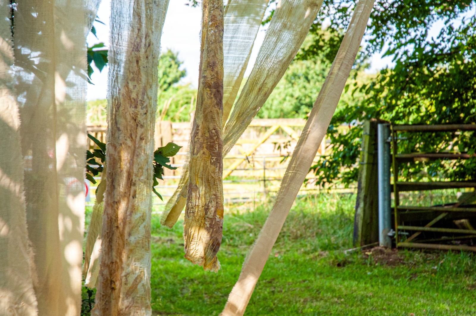
We have also continued our quest to uncover more true stories of the area once known as Westings Meadow. Laying roughly between the Maxey Cut and South Drain, these 500 acres now include four Langdyke reserves. If this remarkable land holds a piece of your history, we’d love to hear from you! Meanwhile, you can read more about Westings Meadow and our work with Langdyke in the articles below.
December 2024
Re-visiting yesteryear
Kathryn Parsons summarises her research into Westings Meadow
Long ago, between the villages of Maxey and Etton, Helpston and Glinton, there was a place known as Westings Meadow. Its long, thin 500+ acres lay roughly between the Maxey Cut and South Drain, though Westings was there long before these waterways were dug …
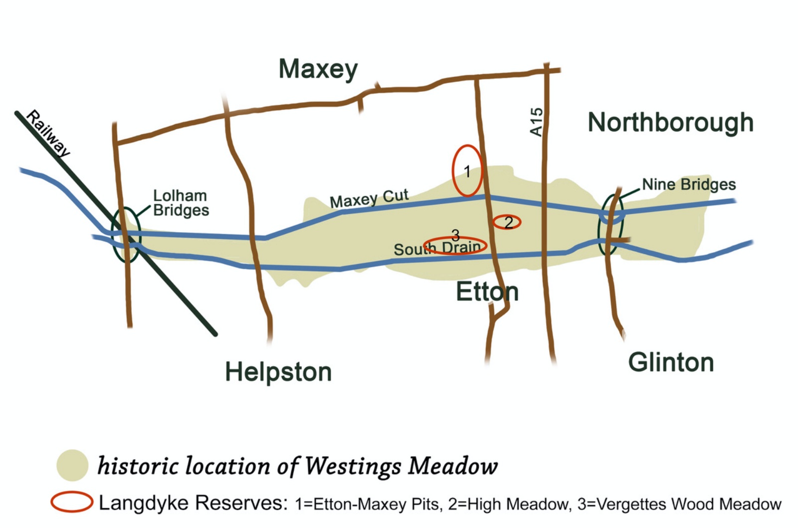
I first came across mention of Westings Meadow early in 2022, in a thesis about landscape history*. The text included a map and I quickly realised that three of Langdyke’s nature reserves sit on the old Westings Meadow site!
I was intrigued and decided to find out more. Since then, working with my co-Artist in Residence, ecologist and photographer Sarah Lambert, we have been exploring the place and delving in to its history. Through our blogs, photography, maps, stitch and sculpture we have been sharing the stories we find.
Here is a summary of our research so far.
The name ‘Westings Meadow’, with various different spellings, goes back to at least the 1260s! It seems that the name fell out of use after the Enclosure Act in 1820, though we’re told some local families still call this area The Meadows.
Back in Medieval and Tudor times, Westings Meadow was divided in to small plots owned by many different people. Each year they would take their harvest of hay, after which others from the surrounding villages could graze their livestock there. It was an intricate, highly regulated farming system aimed at making best use of the land, for everyone’s benefit.
Archaeological excavations led by Francis Pryor in the 1980s at what’s now Langdyke’s Etton-Maxey Pits Nature Reserve showed that Neolithic communities grazed their sheep here too. And they built a huge causewayed enclosure, and other earthworks, extending towards and beyond Maxey too.
Archive satellite images also show evidence of Romano-British farms, Bronze Age ditches and more!**
Visiting in person, Sarah has identified a line of gnarled veteran willows that still mark the north-eastern boundary of the Meadow, and elsewhere there are remnants of the 16th century meadow banks!***
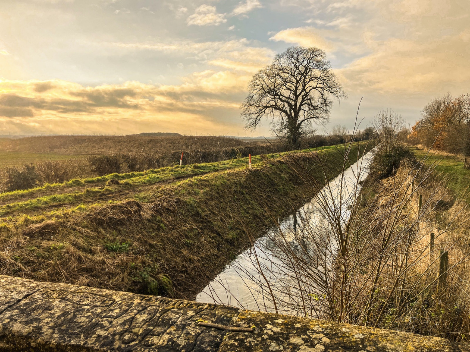
John Clare would have known this area well, and I’ve identified a piece he wrote as being a first-hand account of Westings in the autumn of 1840! It describes red haws on the hedgerows and carvings on the old stone bridges.
The carvings can still be seen in some places. The ones at Etton are particularly clear, with outlines of hobnail boots, hands, a plough and a rough sketch of the church! According to John Clare they were made by bored shepherds and cow-tending boys, while others say they were made by the navvies who dug South Drain. Perhaps both are true.
In the early 1800s, as part of the Enclosures Act, Westings Meadow was divided up with a ruler and the land became entirely private. Over the following years its gentle meandering rivers and soft meadow edges were transformed until straight lines came to dominate the landscape.
Nowadays, Westings Meadow is again in a period of landscape change. It has been quarried for gravel for decades. Field by field the earth is stripped back to reach the deposits below (which means an enormous amount is known about the archaeology of this place). After quarrying, the plots are generally returned to farming or restored for the benefit of nature.
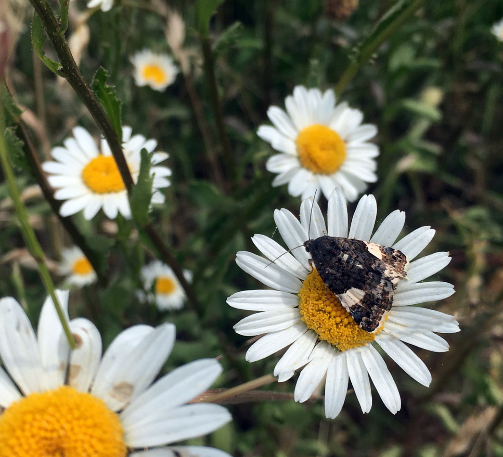
This restoration is vitally important, on a local and national scale. It means that in spring Lapwings have space to nest, while in winter tens of thousands of Starlings delight us with their intricate murmurations! There’s a growing population of Glow-worms, and one of Britain’s rarest moths lives here too – it’s a little black and white day-flying beauty called the Four-spotted Moth.
It’s good to know that these wild treasures have long-term homes. And it feels deeply significant that with Langdyke’s planned purchase of Christ’s College Pits, which is also on Westings Meadow, a place that was a community resource for locals for hundreds of years will once again be cared for by the local community, for the benefit of all.
I’ve heard some people say that the landscape here looks a bit empty … but as we’re discovering, this forgotten meadow and the Langdyke reserves within it are rich with history, fascinating topography and precious wildlife.
With huge thanks to everyone who has helped with the research so far! If you have any memories or photographs of Westings Meadow please contact me at kparsonsart@btinternet.com
*Tracey Partida (2014) “Drawing the Lines: A GIS study of enclosure and landscape in Northamptonshire” (Doctoral dissertation, University of Huddersfield)
**Archive satellite images are freely available online, including via GoogleEarth and at https://livingatlas.arcgis.com/wayback
*** Robert Beasley’s Topology of the Lower Welland (2023) is a trove of information about local landscape change, including on Westings Meadow.
This information is based on research up until January 2024.
Getting the materials together
By Sarah Lambert
As part of out Artist-in-residence work in 2024, Kathryn Parsons and I plan to make joint visits to Langdyke Countryside Trust’s reserves at least once a month, to seek creative inspiration and materials for our art.
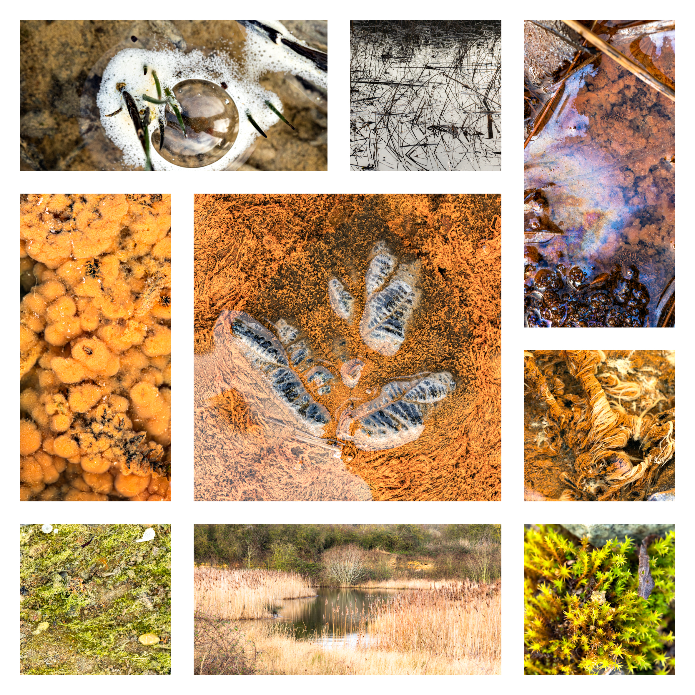
Earlier in January we visited Swaddywell Nature Reserve and could scarcely contain our delight at finding the quarry springs and seepages in full flow, water appearing in places where it hasn’t been seen for years.
Chalybeate springs emerging from the underlying iron-rich limestone had created rust-red oozes, whose water spilled over creating ephemeral streams. Skeins and spherical colonies ofbacteria drifted in the flowing runnels, recalling seaweed waving rhythmically in a rockpool.
The surfaces of still-water pools were rainbow-hued, a beautiful by-product of iron-digesting bacteria – as we touched the delicate skin it shattered into a myriad of angular fragments.
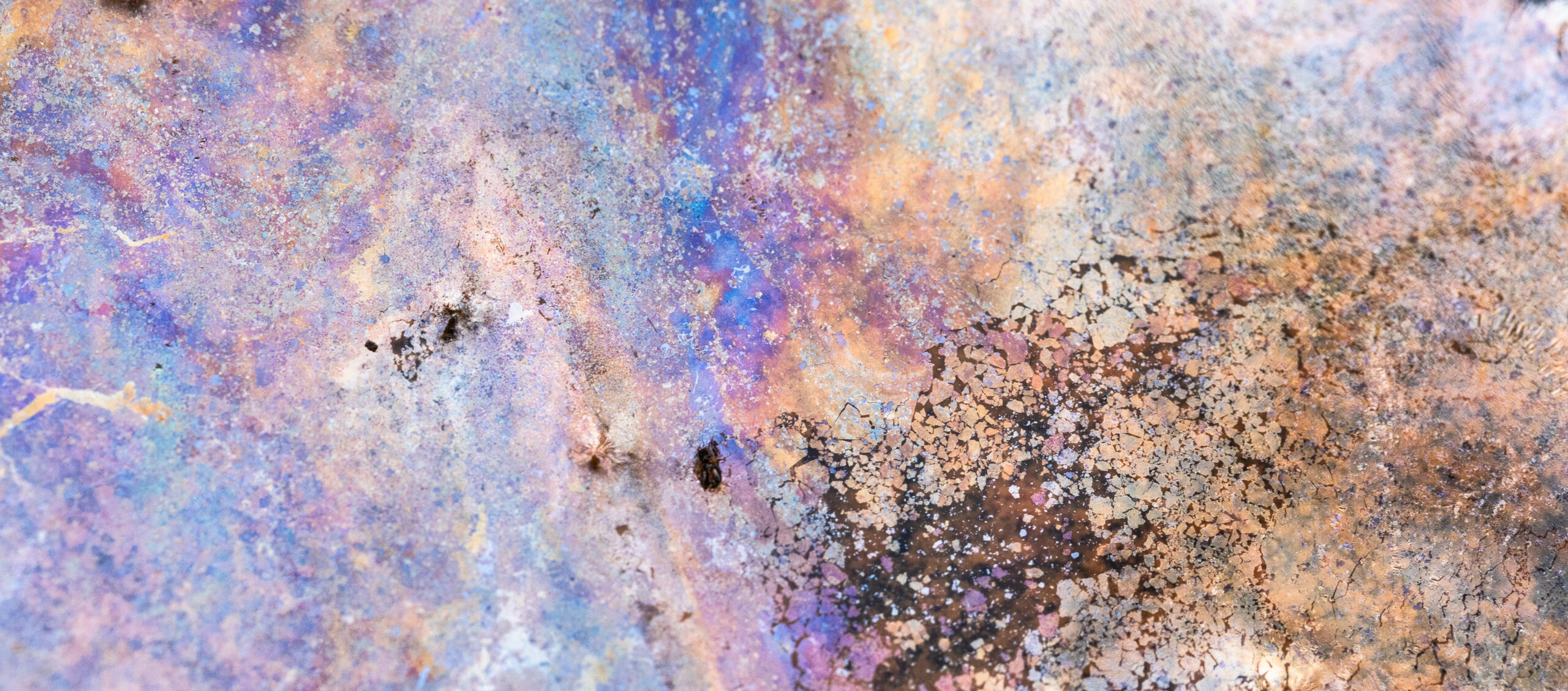 Despite the mostly leaden January skies, there was colour all around.
A brief glimpse of low winter sun illuminated the limestone cliffs. stained with vivid yellow and acid-green lichens, and brushed the reed beds with soft copper-tinted light.
While I was busy with my camera, Kathryn gathered charcoal from the volunteers’ recent bonfire and wild clay from the cliff base.