


Vergette Wood Meadow has been farmed by the Vergette family for many generations.
In the first decade of the century it was quarried for gravel and restored as a wild flower meadow and wet woodlands.
The land became a Langdyke nature reserve in 2018 – consisting of an area of periodically flooded meadow and wet woodland.
Little grebe, coot and Mute swan nest in the flooded areas and hobby and barn owl can often be seen hunting overhead. Snipe feed here in the winter when other ducks including pintail and tufted duck find shelter on the water.
Grass vetching and tare flower in the meadow and flocks of linnet are often seen in the hedgerow that runs parallel to the South Drain.
Turtle dove are regularly seen in the area and their gentle purring call can be heard from the hedgerows.
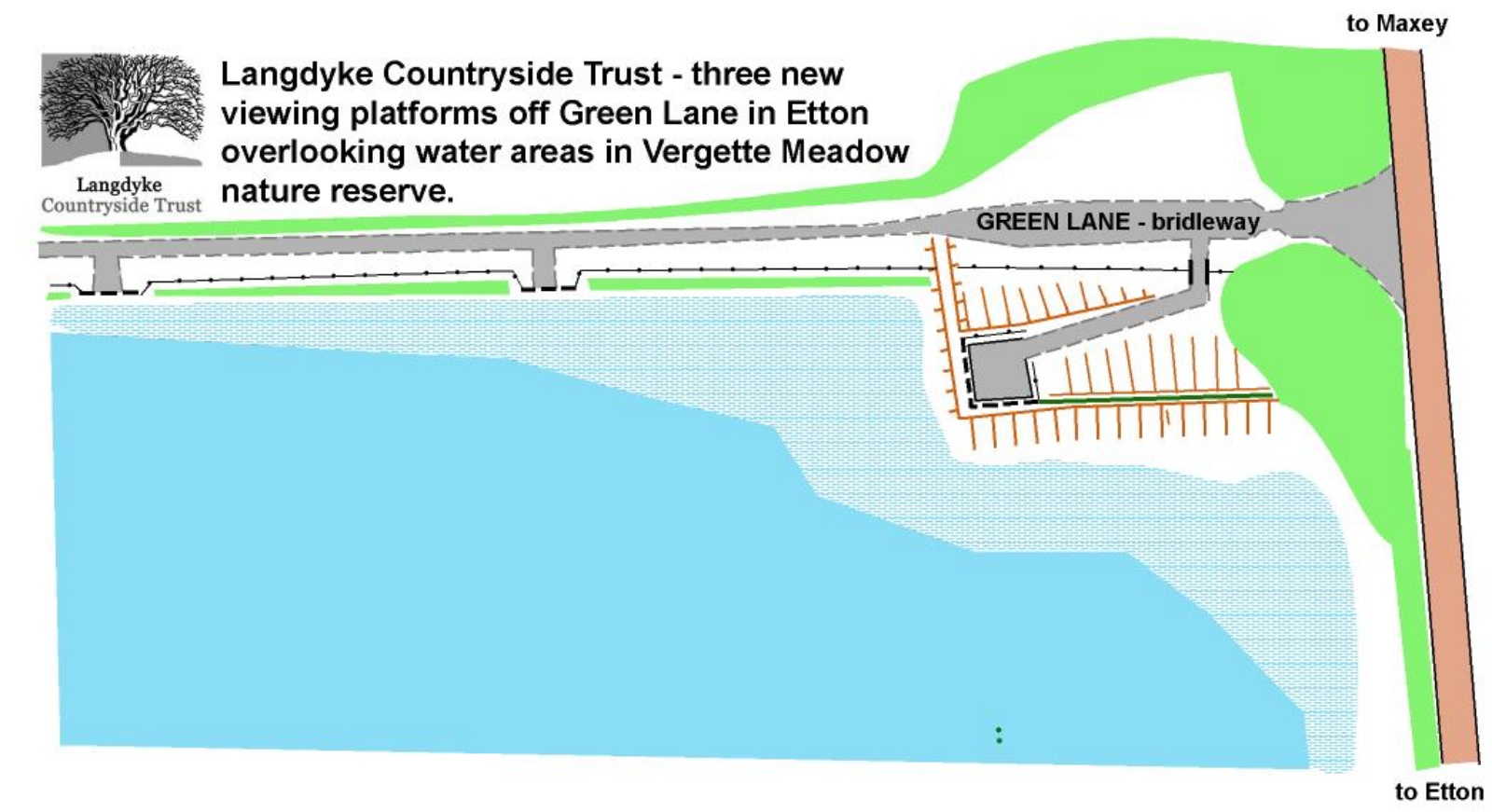
In June 2024 work was carried out to create a viewing platform over the wet area of the reserve.


The Drain and the Drift
Two areas of land running in line alongside the South Drain and bordering Vergette Wood Meadow are also under the stewardship of Langdyke.
The Drain is the land directly adjoining Vergette Meadow. The Drift is the area of land further along at the other side of the temporary bridge used by Tarmac vehicles to extract gravel from the nearby pits. Both are managed by the Trust.


Gravel extraction a key to the area
Gravel extraction is a key resource of a developing area such as Cambridgeshire, with lowland river valleys such as the Welland, and Etton/Maxey dense and active locations.
Two unintended benefits for conservation are that it breaks up the “arable desert” and disturbs the land-ownership values and patterns such that on restoration parcels of land are released with little of their original value.
This is the background to Langdyke being able to take a long-term rent on this parcel of land directly opposite Etton High Meadow.
The recent usage pattern perhaps points to a four-year rotation as a model for other reserve pasture – graze, graze and flail, fallow, fallow and flail, being the sequence.
In the fourth year (2018) late spring/early summer produced a spectacular result for ex-arable land – sixty species of plants being recorded on an initial survey.

Many were in common with Etton High Meadow across the road, but Grass Vetchling and Smooth Tare illustrate the potential for much greater meadow richness – or being further down the rejuvenation path. Maintaining the wet woodland will be a learning opportunity.
Otherwise we hope for a low-maintenance regime, perhaps following the four-year rotation to ensure one area of the meadow is always in the rich sward condition, with some ideas for limited public access (and control) in this site which borders Peterborough’s Green Wheel.
How to find the site:
What3words: ///smudges.retailing.passenger
Co-ordinates: 52.64719N 0.31550W
- There is no public access to the site but there are good views across the meadow from the South Drain and across the woodland from the Green Lane using three different viewing areas including a main platform. The Trust also organises regular work parties on the reserve which are open to all. Dates of these work parties are usually advertised on the the group’s website.